

Panorama of the storm that developed as I "chased" it to the ocean. Click here for a full version.
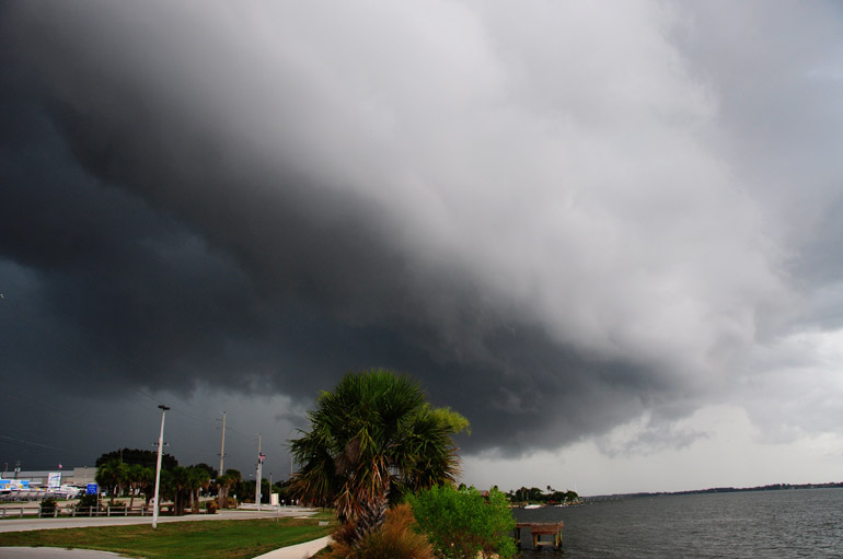
My first stop was a park near a little town called Palm Shores (it derives its namesake from the Indian River). This is where the clouds started to develop some structure. Radar showed some rain activity off to the west by this point.
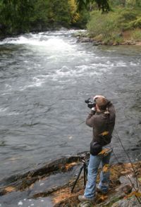
First of all, I resent the term "chase" when it comes to weather photography -- simply because it has the connotation that you're behind something and you're trying to catch up.
I just think it's good to be ahead of the weather. I like to let it come to me.
Unfortunately, that was not the case on the first day this season that I dedicated to weather photography. So yeah, I guess you could call this a "chase."
I just think it's good to be ahead of the weather. I like to let it come to me.
Unfortunately, that was not the case on the first day this season that I dedicated to weather photography. So yeah, I guess you could call this a "chase."
I've spent the past two days tracking down clouds that are popping up regularly in Brevard County now that our rainy season has finally begun (that post is coming later).
Without social events scheduled, I pretty much dedicated myself to this activity.
And it started early Saturday afternoon.
Radar showed a few showers to the south and to the north, but I looked to the sky and decided to trust my own instinct on a few dark clouds to the west. (Truthfully, I have no instinct; I don't know what I'm doing. I just like clouds.) So I got in front of them, and it turned out that a severe thunderstorm formed right over my head.
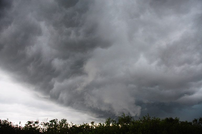
Unfortunately, I wasn't far enough south to get an overall view. Photographers in Indian Harbour Beach -- about 6 miles from Patrick Air Force Base, where I ended up -- got shots like this of a beautiful shelf cloud (the leading edge of a well-developed thunderstorm's outflow, also known as a gust front).
Better luck next time. And hopefully there will be plenty of next times this summer.
Without social events scheduled, I pretty much dedicated myself to this activity.
And it started early Saturday afternoon.
Radar showed a few showers to the south and to the north, but I looked to the sky and decided to trust my own instinct on a few dark clouds to the west. (Truthfully, I have no instinct; I don't know what I'm doing. I just like clouds.) So I got in front of them, and it turned out that a severe thunderstorm formed right over my head.
Unfortunately, I wasn't far enough south to get an overall view. Photographers in Indian Harbour Beach -- about 6 miles from Patrick Air Force Base, where I ended up -- got shots like this of a beautiful shelf cloud (the leading edge of a well-developed thunderstorm's outflow, also known as a gust front).
Better luck next time. And hopefully there will be plenty of next times this summer.
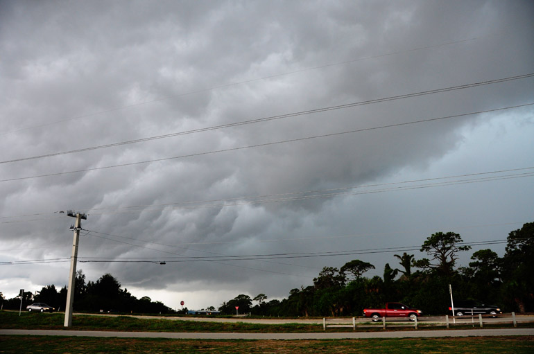
The turbulent, ragged appearance of the clouds -- also known as the "whale's mouth" effect -- provides a clear sign that there's plenty of air movement.
There were a few scuds, or clouds that droop from a larger one. They're often mistaken for funnels, but they have no rotation.
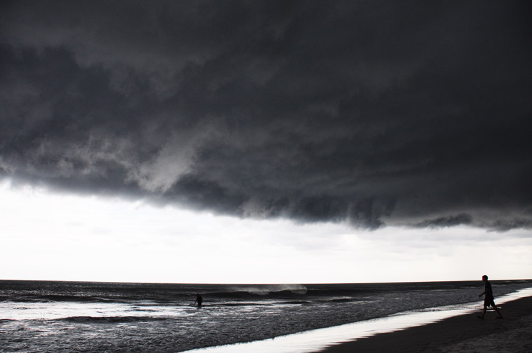
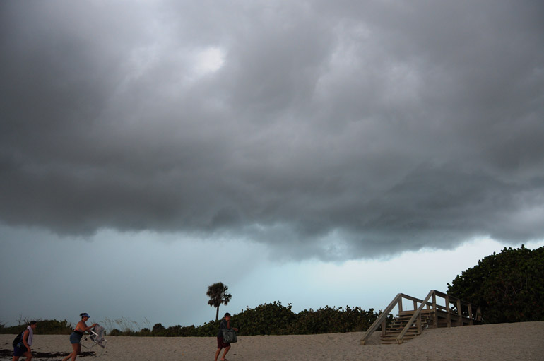
This is where my chase ended, for obvious reasons -- the utmost of them being that I don't have a boat to chase on the Atlantic Ocean.
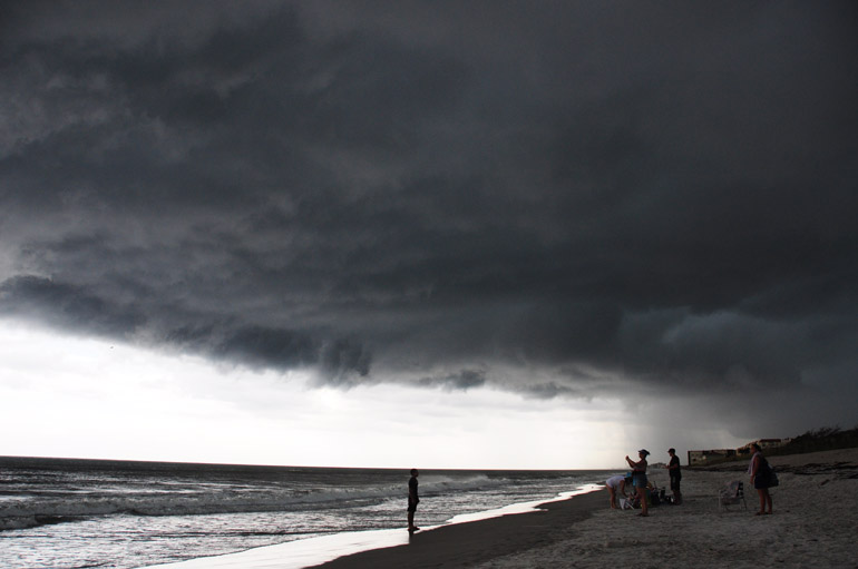
I always run into tourists who are fascinated by the clouds (like I am, even though I'm not a tourist). But at this point, people left on the beach needed to gather their things and get moving. It's not the best place to be when lightning starts getting frequent.
I turned around and tried to snap some shots of lightning, but it was too fast and shifty. The tourists got smart and left. I stayed standing next to my tall tripod.
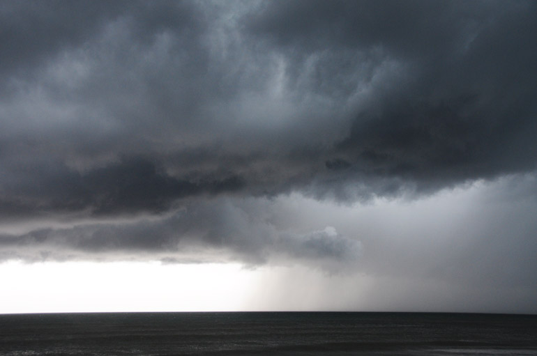
The rain fell over the ocean to the south. I was still dry on the beach at Patrick Air Force Base.
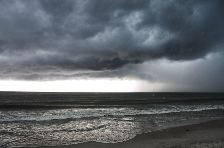
Now the rain comes, and I go.

No comments:
Post a Comment