Thursday, February 25, 2010

Big birds of Viera's man-made wetlands

web_craneclose_wetlands_0025_2549
In the past several weeks, while running errands, I've stopped by Viera's Ritch Grissom Memorial Wetlands a few times on a whim. It's conveniently located near many of the stores in Viera that I frequent, so taking a slight detour through the wetlands to see what's flying around on a particular day is not much to ask. After all, I always have my camera with me, and one never knows what critter will make itself visible, even during the briefest of visits to such a wildlife refuge. On one of those days, a sandhill crane landed on the bumpy dirt road in front of me.

web_cranedrops_wetlands_0017_2548
The crane made its way to the edge of the water, where it browsed for food.

web_heronhair_wetlands_0062_2550
Another common, large bird at the wetlands is the great blue heron. This one was having an Alfalfa-style hair day.

web_herongold_wetlands_0035_2556
This heron was stalking fish when I visited late in the afternoon, during the golden hour.

web_heronlanding_wetlands_0038_2557
I thought the heron had spotted a particularly large fish. Or, at least, something moved it to fly a short distance, feet skimming on the water's surface, then plop back down into the swampy grass. It caught no fish, though. I guess it was just skittish behavior on account of the photographer pointing a large camera lens in its general direction.

Friday, February 19, 2010

Snow search in Appalachia | A few final shots, from West Virginia's capital

web_capitol_charleston_0004_2551
The West Virginia Capitol in Charleston, amid a light snowfall.


When I rolled out of my cheap, cold motel room bed in Charleston, West Virginia's mountain-lined capital city, another light snowfall was coating surfaces outside. But I was disappointed that it wasn't coming down harder. The forecast had called for three inches of snow, and I was hoping that it would thoroughly blanket surfaces by the time I woke up.

On the bright side, traveling was easy. I parked in downtown Charleston and walked around the Capitol complex for a few photos. As in many two-newspaper towns today, Charleston's daily publications - The Charleston Gazette and Charleston Daily Mail - are housed in a single building under a joint operating agreement. They're located in the downtown, just a walking distance to other businesses and restaurants. Such a setup made me miss the urban setting I was accustomed to working in, even at the paper in Maine. In Florida, nothing is within walking distance.

After fueling up on coffee and a sandwich from a popular place in downtown Charleston, Blossom Deli, I embarked on the 12-hour trip home to Florida. The trip, surprisingly, was easy on the gas tank. I can only surmise that the reason I made it from Charleston to Georgia on one tank of gas was because I was going downhill most of the way. Interstate 77 in North Carolina is where the serious descent from the Appalachians takes place. The snow disappeared before the South Carolina border, and the sailing was smooth from there to Melbourne.


web_snowflake_charleston_0015_2552
None of the landscapes were that interesting, so I focused my macro lens on a snowflake on the rock wall lining the sidewalk.

web_snowflakeleaf_charleston_0030_2553
A flake on a leaf.

web_bridge_charleston_0052_2555
The South Side Bridge, with a train station on the other side of the Kanawha River.

web_bridgetree_charleston_0042_2554
Another view of the bridge.

Thursday, February 11, 2010

Ironically, sun makes photographing launch of solar observatory quite difficult

web_atlasv_liftoff_0082_2559
On the second attempt, the weather cooperated for an Altas V rocket to deliver NASA's Solar Dynamics Observatory into orbit Thursday morning. For the first time, I shot the launch from Playalinda Beach, which is part of the Merritt Island National Wildlife Refuge and is sometimes closed for launches from Cape Canaveral Air Force Station. At five miles, it's the closest that members of the public can get to an Atlas V launch. Beach access nearer the launch pad is restricted, so many people gather near a fence that NASA constructed for the safety of the public. Above, the rocket lifts off. It did not have solid rocket boosters attached, so there is no visible smoke trail. Such configuration also reduces the rumble that observers hear.

web_bluesky_atlasv_0090_2560
Being south of the pad for this 10:23 a.m. launch meant that the sun was shining directly at me. This made exposing the sky and the rocket very difficult. As is the case in all of these photos, the rocket is dark because of the harsh sunlight.

web_contrail_atlasv_0116_2561
As the rocket hit colder temperatures in the atmosphere, a contrail began to condense. This was taken just after the rocket passed in front of the sun, at which time my camera seized up because of an overload of light. As is apparent from this photo, it was impossible to correctly expose the sky and the contrail. But what resulted was an interesting, contrasty shot with only the contrail exposed correctly. The photo also appears monochrome, aside from the rocket engine's flame.

web_suncontrail_atlasv_0126_2562
The contrail dissipates as the sun continues to mercilessly beat down on the beach. It wasn't warm, though: The temperature was about 40 degrees. A 20-mph wind made it feel colder.

web_crowd_atlasv_0130_2563
Photographers gather their equipment after the launch. It wouldn't be difficult to scoot through this fence, but the Air Force mans a nearby watchtower to prevent that from happening - or to punish people who do make that happen.

Tuesday, February 9, 2010

Cedar waxwings, robins rob Florida of its berries

web_waxwingrobins_birds_0028_2545
A combined flock of migratory cedar waxwings and robins assaulted the berry tree in front of my apartment the other day. They've been going from tree to tree in Melbourne until each is plundered of its fruit. I've never seen something quite like this in my few years in Florida.

web_waxwingflock_birds_0009_2544
Waxwings perch on the tree.

web_waxwingsrobins_perched_0048_2547
The two bird species seemed to be courteous to each other while chowing down.

web_robin_birds_0031_2546
Within hours, all of these berries were gone.

Monday, February 8, 2010

Snow search in Appalachia | West Virginia's country roads

web_deerescape_pocahontas_0112_2505
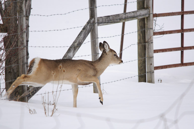
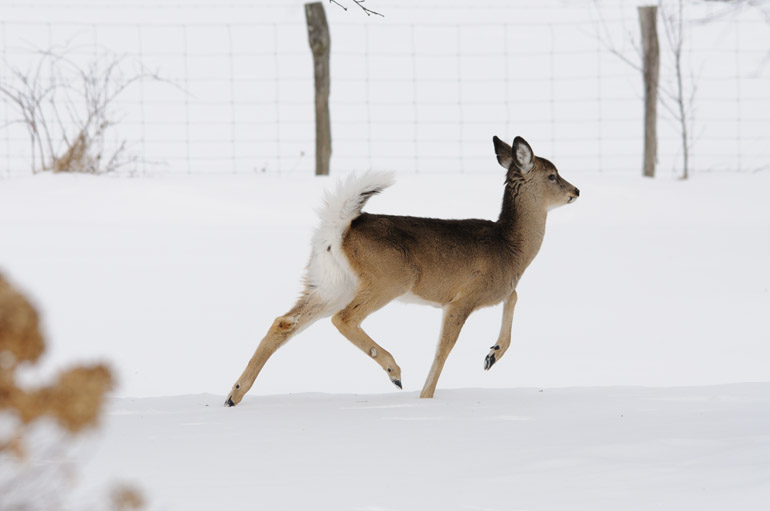
Pocahontas County, a rough and rural region on the central West Virginian border with Virginia, is highly populated with small whitetail deer. This one was feeding in the front yard of a home when I spooked it. The animal is climbing through a barbed fence.

web_deerun_pocahontas_0106_2504
The deer dashed away into a snowy field.

web_evergreenssky_snowshoe_0132_2506
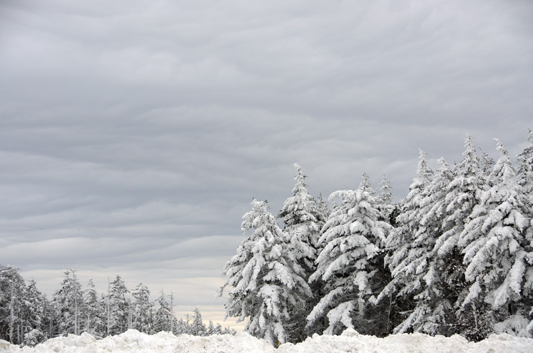
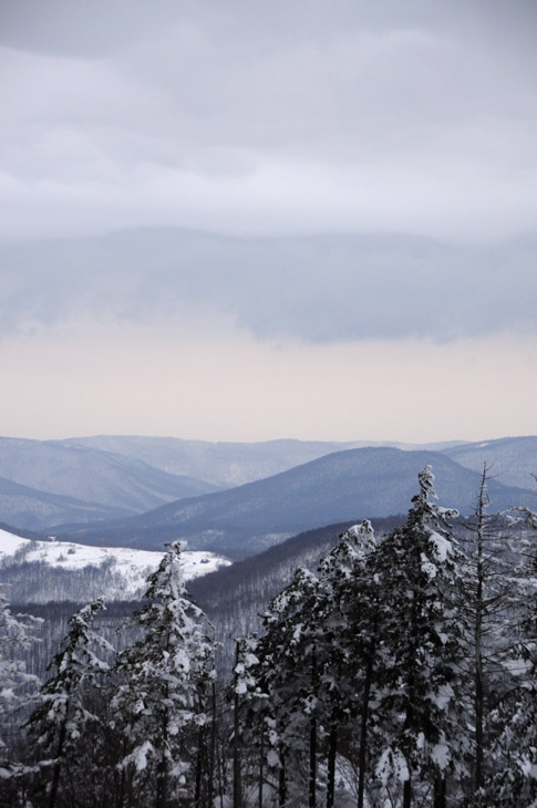
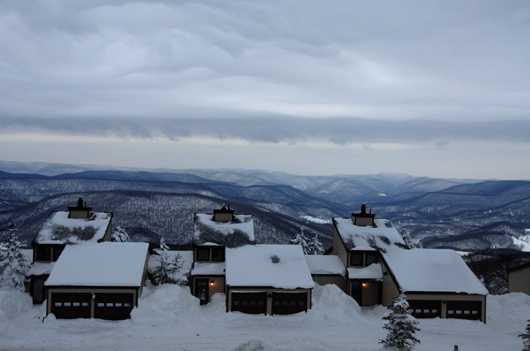
The top of Snowshoe Mountain, home of one of West Virginia's popular ski resorts, provided the snowiest vistas of my trip. In addition, the cloud layering provided an interesting background for the landscapes at 4,850 feet.

web_deerpose_snowshoe_0155_2507
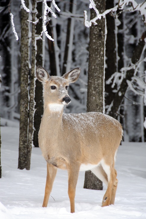
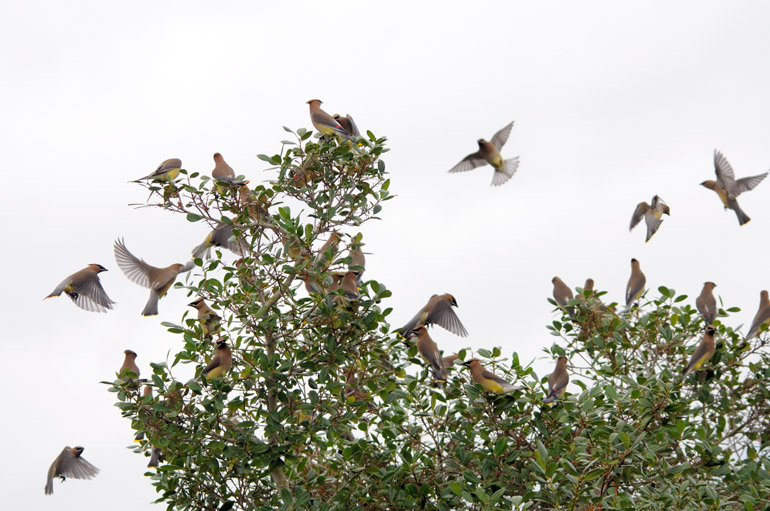
Even high on the mountaintop, deer roamed freely.


In daylight on Monday, the third day of my weekend snow search, West Virginia and its small towns reminded me of home in Maine. Rifles hung from the window racks of pickups. All towns, no matter how small, had more than one church. Gas stations allowed people to pump fuel before paying. Boys walked down the street, many smoking a cigarette and dressed in dirty jeans and a baseball cap. The mailman drove a regular vehicle with a Postal Service sign on top.

After fueling up on coffee and briefly exploring Lewisburg, in beautiful Greenbrier County, I drove north on State Route 92 through Seneca State Forest and Monongahela National Forest. There were several points along the way when I saw a scene I wanted to photograph - perhaps a house in a field, a snowy fence or a hillside littered with deer. But for the most part, there were simply no places to park along the road. So, much of the trip was about me enjoying the moments rather than capturing them with a camera.

A series of turns later and I was on a steepening road in Pocahontas County, leading to Snowshoe Mountain Ski Resort. A co-worker, who's a native West Virginian, said there was a high probability of deep snow on the mountain, which rises about 4,850 feet above sea level. When I reached the top, the evergreens were coated in white stuff, but the sky was darkening, and flurries began to fly. I knew more was on the way, and if I wanted to get back to civilization alive, I couldn't stay long at Snowshoe.

After taking photos of the approaching storm system and of other scenes throughout the resort, I embarked on one of the most hair-raising experiences of my 26 years on this planet. For 87 miles, I traveled over corkscrew roadways that led up and over mountain after mountain. The worst part: I couldn't see but 15 feet in front of my car. The snow was coming down at a horrendous clip, and the sun had called it quits for the day. The road was so covered that I couldn't see the yellow lines. I didn't meet a single snowplow that could have made a path for my light, two-wheel-drive sedan. There weren't many homes that could have provided a refuge. And there wasn't any hope of getting a cell phone signal.

There was a point on those country roads of Pocahontas County when I wanted to punch John Denver, if he were still alive. Those country roads weren't taking me to a place I belonged.

There were a few bright sides, though. I had nearly a full tank of gas, so I could have pulled over and waited out the storm in my warm vehicle. And the roadside snowbanks were so high that they would have prevented me from plummeting over a cliff if I were to lose control.

At a average 20-mph clip, it took hours to make it out of the wilderness near Sutton, in the central part of the state, where I entered Interstate 79 southbound toward Charleston. It was a death-defying experience, one that produced zero photographs and a lasting memory to cherish until the next time I get stuck in a snowstorm.


web_oldchurch_lewisburg_0011_2494
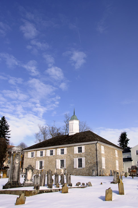
A 214-year-old Presbyterian church in the small city of Lewisburg served as a makeshift hospital during battles of the Civil War.

web_depot_whitesulfursprings_0025_2495
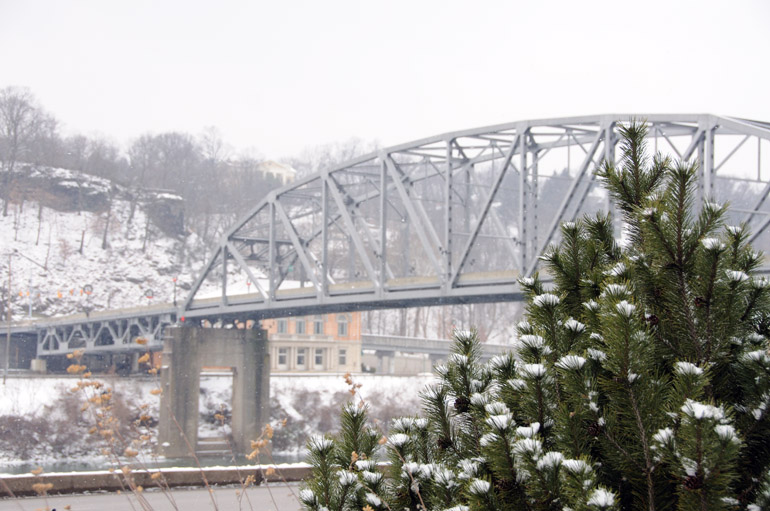
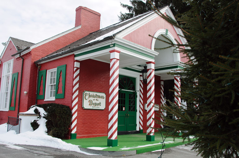
I noticed elements of the Christmas season still hanging on. This train station sits near The Greenbrier, a casino-golf-spa resort in White Sulphur Springs.

web_bridgegreenbrier_whitesulphursprings_0041_2496
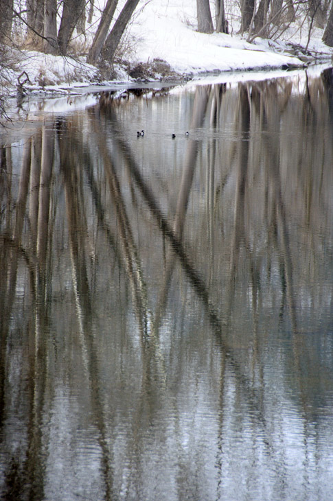
Trees reflect on the surface of Howard's Creek in White Sulphur Springs.

web_mountain_anthonyroad_0049_2497
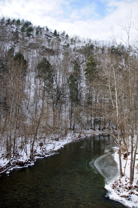
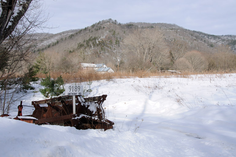
In Monongahela National Forest, I took a brief detour onto Anthony Road, which afforded many similar views of Anthony Creek.

web_beer_anthonyroad_0053_2498
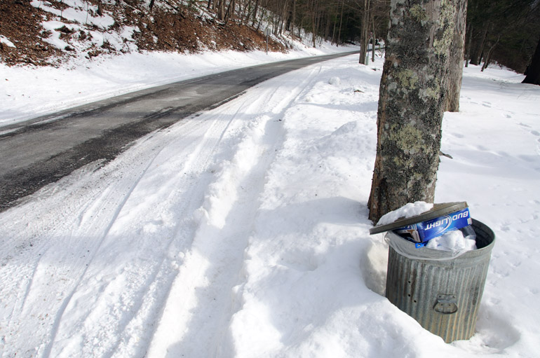
Apparently, I just missed the party. But I was expecting empty bottles of moonshine, not Bud Light cartons.

web_tracks_anthonyroad_0060_2499
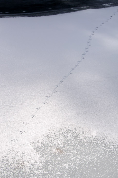
Bird tracks lead across thin ice over Anthony Creek.

web_sign_anthonyroad_0064_2500
People who live here must enjoy their lives of seclusion.

web_turkey_route92_0066_2501
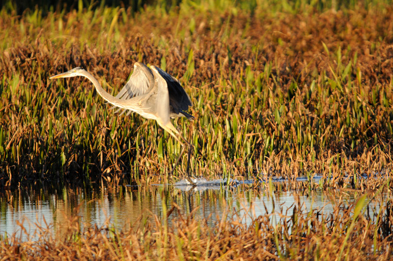
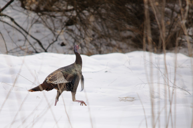
I spotted a pair of turkeys along State Route 92 through Monongahela, and I shot one of them. Because of the snow, this was one of the few spots where there was room to pull over and take photos.

web_corn_route92_0073_2502
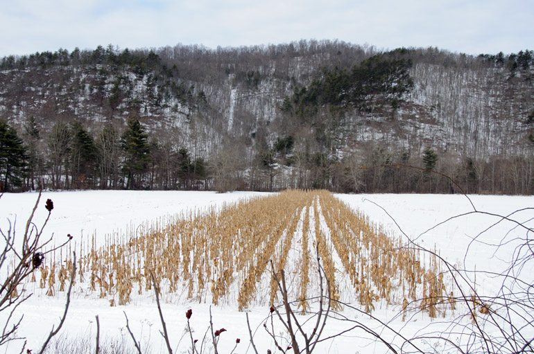
Many of these scenes, including this cornfield, weren't particularly picturesque. It might have been better after a fresh snow. Despite that, I risked getting stuck for this photo by pulling onto the snowy roadside. Then, I cut myself somehow on a prickly barb in the stand of sumac in the foreground. Poor me.

web_barn_pocahontas_0082_2503
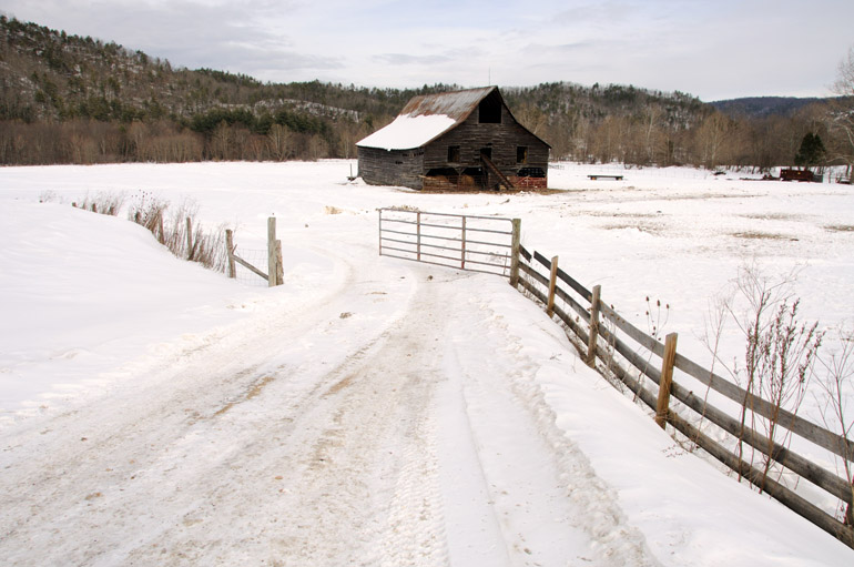
These scenes were prevalent through Pocahontas County. I was able to shoot this one only because it was next to a gas station with a somewhat plowed parking lot.

web_house_snowshoe_0161_2508
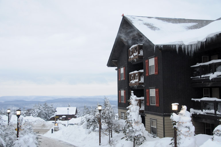
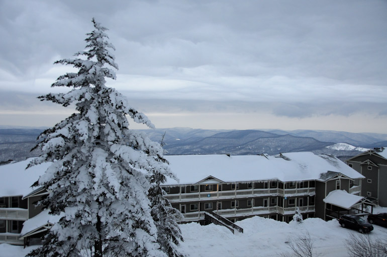
Snowshoe Mountain is full of many lodging communities for visitors. I wasn't about to pay to spend the night, though, despite an oncoming snowstorm that could have stranded me in the mountains.

web_skier_snowshoe_0168_2509
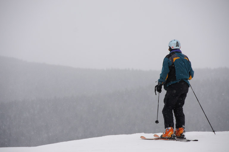
A skier surveys one of Snowshoe's slopes as snow begins to fall. Unfortunately, I wasn't dressed to go trekking over the slopes.

web_car_snowshoe_0172_2510
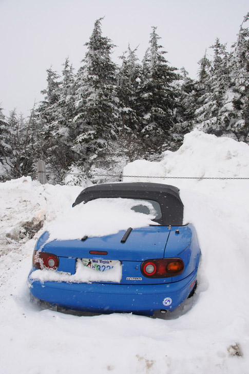
A convertible is appropriately stored and insulated for the winter.

web_suntree_snowshoe_0188_2511
The sun peeks through the overcast sky. At this point, I was becoming highly irritated by the conditions. My hands were withering and being sucked dry by the cold, and even my camera was slowing down in the single-digit wind chills.

web_santa_snowshoe_0192_2512
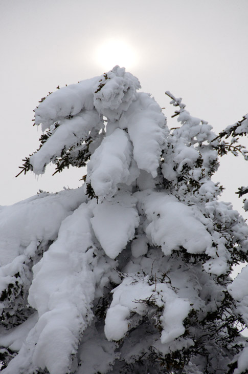
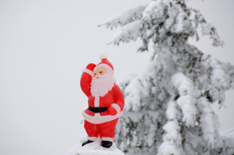
At Snowshoe, another anachronism.

web_window_snowshoe_0195_2513
Snowbanks on the sides of buildings partially covered some windows, including this one on a medical clinic.

web_blowingsnow_snowshoe_0197_2514
Snow blows off an icicle-lined roof.

web_church_snowshoe_0210_2515
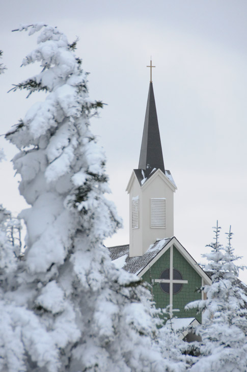
The resort's chapel.

web_walkway_snowshoe_0221_2516
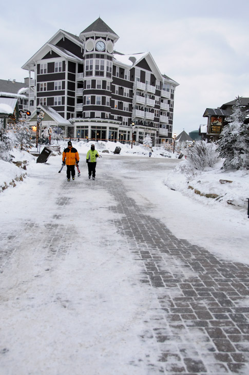
The main walkway through the resort's shopping district.

web_verticalmountains_snowshoe_0224_2517
The last vestiges of sunlight filled the horizon. I'm sure scenes like this would be beautiful in the fall, so I might have to return.

web_lodge_snowshoe_0229_2518
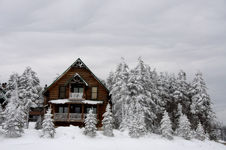
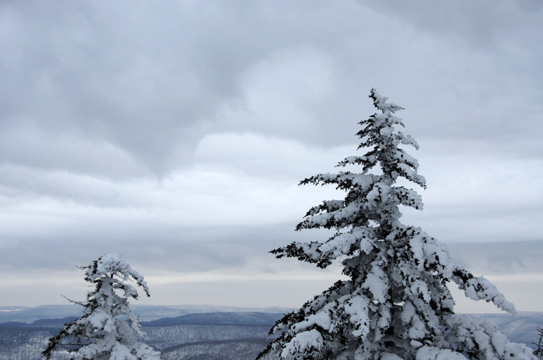
A layer of clouds approaches over a mountain lodge, a sure sign of the oncoming storm.

web_tree_snowshoe_0232_2519
The sun faded, and the clouds darkened.

web_townhomes_snowshoe_0239_2520
The trip down the mountain and toward the nearest highway, 87 miles away, was when the real fun began after I snapped this final shot at Snowshoe.

Possibly the shuttle's last night launch - but the start of NASA's dark times

web_timelapse_endeavour_0021_2543
Purchase a print | Circumstances didn't permit me to get a time-lapse shot of the launch from the Indian River, so I settled for the grassy dunes of the beach in Cape Canaveral.

web_crescentmoon_endeavour_0003_2542
A crescent moon rose while I waited for the launch.


After failing horribly at shooting my first nighttime shuttle launch, I finally got a usable photo of Endeavour from a location closer to Kennedy Space Center. For all launches since that March 2008 lesson in how to shoot a time lapse, I've been relegated to setting up my equipment from outside work in Melbourne.

Fortunately, I had Super Bowl Sunday off, so I headed to the beach in Cape Canaveral around 3:30 a.m. Monday without a care of what was happening at the newspaper. But I knew that if the shuttle were scrubbed again Monday morning, as it was because of weather Sunday, I probably wouldn't get this last chance. The next try would have been on Valentine's Day, when I'm scheduled to work.

But the sky cleared nicely, and Endeavour lifted off as planned at 4:14 a.m., lighting up the beach and overpowering a reddish crescent moon as the brightest point in the sky.

The launch likely is the final one of a space shuttle under the veil of darkness. Only four missions remain until the predicted September retirement of the fleet, and they're all scheduled during the day. If those dates change for any reason, however, we might have another night launch, which really isn't such a long shot. NASA's plans change as quickly as the weather in Florida.

Ironically, Endeavour was the first shuttle I saw lift off at night, when I failed miserably at getting the shot from Titusville. It's just fitting that it could be the last.

But speaking of miserable failures, President Barack Obama's budget for NASA, though larger than expected, is a dagger into the heart of America's space agency. The extra money, about $6 billion, is for NASA to entice corporations to build rockets capable of launching astronauts into orbit - an endeavor without a track record, worrying safety experts. It effectively cancels Project Constellation, devised during President George W. Bush's tenure. With it, dreams of landing on the moon again won't be realized anytime soon. Obama's decision to take away from NASA what it has done since it was founded - send humans into space, either to circle Earth or touch another heavenly body - has put a damper on the mood at Kennedy Space Center and throughout Central Florida in the past two weeks.

With the shuttle's end, 7,000 people are expected to lose their jobs at KSC. Several thousand more probably will be laid off in the community because of NASA's cuts. And Obama's budget means that the NASA figure likely will rise. So as the economy may improve nationwide, the recession in Brevard County - which I like to call the Silicon Valley of the East Coast on account of its tech-heavy employers - will be prolonged.

It's a real shame and a turnabout that hurts this area deeply. Even our Democratic members of Congress have spoken against the misguided budget. NASA Administrator Charles Bolden, a former astronaut, seems to be simply going along for the ride on Obama's omnibus.

Monday's launch attracted people from throughout the world, as one always does. After Endeavour's successful liftoff, the Waffle House, Dunkin' Donuts, McDonald's, IHOP and Denny's in Cocoa Beach were packed with spectators filling their stomachs with a hot breakfast (it was a chilly evening). And after the scrubbed attempt Sunday, the roads in Brevard were jammed. But without the shuttle, or any specific spaceflight program to replace it, such sights are numbered in the cities and towns of the Space Coast, a community built on an other-worlds curiosity, as its name suggests.

Pathetic as it sounds, the Space Coast will have to enjoy this "strong" economy while it lasts.

Thursday, February 4, 2010

A coot, its feeding friends and a dinnertime enemy on Merritt Island

web_cootswide_merritt_0298_2529
Purchase a print | This is a story - a sad one at that - of a bird at the Merritt Island National Wildlife Refuge. It's one of the coots in this flock over the shallows along Blackpoint Wildlife Drive. The gathering of thousands of birds representing many species attracted a large group of birdwatchers and photographers, including myself.

web_skimmers_merritt_0363_2536
Purchase a print | The coots were joined by other birds, such as these black skimmers, late in the day Wednesday. The two photographers standing next to me were jealous when I shot this of the two birds feeding symmetrically alongside each other.

web_cootsvab_merritt_0390_2538
A flock of coots is known as a cover. This cover teamed over the water with NASA's Vehicle Assembly Building in the background.

web_cootsclose_merritt_0292_2528
The coots in the center of this flock splash around while feeding on the vegetation.

web_spoonbillcoots_merritt_0267_2526
A few roseate spoonbills were mixed in with the coots - this one just taking off.

web_heron_merritt_0215_2524
Purchase a print | The Louisiana herons had it easy. Their long legs permitted them to stand high above the shallows and pick out minnows for an easy dinner.

web_heronfish_merritt_0211_2523
Purchase a print | This heron was catching one after another.

web_three_merritt_0190_2522
Dozens of sandpipers were gathered in one area. I spotted these three and snapped a shot to represent their vast population.

web_nasaone_merritt_0396_2540
The only things that tend to break the silence at the refuge are artificial birds from America's space agency.

web_nasatwo_merritt_0421_2541
The two NASA jets were in the process of taking off from the Shuttle Landing Facility at Kennedy Space Center, which is located on Merritt Island, too. The planes glowed in the late-day day golden sunshine.

web_egretdark_merritt_0161_2521
Purchase a print | A snowy egret looks for a dinner of fish.

web_egretflying_merritt_0219_2525
The egret sometimes used its wings to hop near a school of fish.

web_cootsscared_merritt_0323_2530
But all the birds silently feeding were interrupted. The flock of coots began to stir, then ran frantically across the water.

web_flock_merritt_0393_2539
Another flock of sandpiper-like birds, here only for the winter season, was spooked, too.

web_tandem_merritt_0269_2527
A pair of white ibis flew away promptly.

web_spoonbillflying_merritt_0324_2531
Purchase a print | A spoonbill followed.

web_twospoonbills_merritt_0368_2537
More spoonbills went in the opposite direction.

web_eaglesoaring_merritt_0328_2532
Purchase a print | Someone in the group of bird-gawkers said, "Look up! It's an eagle!" (a bird species I don't see too often here in Florida). It soared slowly downward.

web_eaglegrab_merritt_0332_2533
Purchase a print | Everyone in the group knew that the eagle must have been after an injured or dead coot; we couldn't quite see for sure, though.

web_eagledinner_merritt_0335_2534
Purchase a print | The photograph of the eagle flying off with its meal, though, confirmed that it was a coot.

web_eagleleaving_merritt_0337_2535
Birds continued to flock away from the formidable eagle. The eagle dispersed the thousands of birds - and the photographers who no longer had anything to photograph.