Monday, June 27, 2011

Towering clouds and a solar halo on U.S. 192

web_192chase_stopsign_0026
I got ahead of the storms Sunday but wasn't necessarily watching the best systems of the day, like I did Saturday. I traveled a short distance to U.S. 192, an east-west corridor from Melbourne to Kissimmee. Early in the afternoon just west of Melbourne, I watched these cumulonimbus clouds build in a matter of minutes. It created a thunderstorm that moved southeastward toward Palm Bay.

web_192chase_nimbus_0031
An hour earlier, there were just plain old clouds here. This is an overall shot of the isolated storm, showing some rain falling toward the coast.

web_192chase_sun_0021
Storm formation was hindered most of the day by cirrostratus clouds, which prevented extensive heating and thus severe thunderstorms. They did, however, cause this halo around the sun.

web_192chase_lowclouds_0047
This storm started gaining some structure. There was some lightning, and that's what I was trying to capture in this shot, taken near a hotel at Interstate 95 and U.S. 192.

web_192chase_towerstrike_0287
Later in the day, a storm formed way down south near Vero Beach. It produced rotation and a tornado warning there. Then, it split into two separate storms. One remained fairly strong and traveled northward toward U.S. 192. I waited for it there, trying to catch some lightning as it approached. During the daytime, such a task is difficult when you're not equipped with a lightning-initiated shutter trigger. I basically have to watch for a bolt, then hold down the button in an attempt to capture a portion of the bolt. I only caught a small bit in this shot.

web_192chase_storm_0064
The gust front neared U.S. 192, but it started to fall apart. Just before the storm reached the roadway, it lost all energy and lightning. Only light rain fell. That was somewhat disappointing.

web_192chase_lightning_0074
The only decent lightning shot of the day. I was hoping the tower would get struck, but I wasn't quite that lucky.

Wind, fire and water: Shelving Brevard County's prolonged dry season

web_Ddry_0039
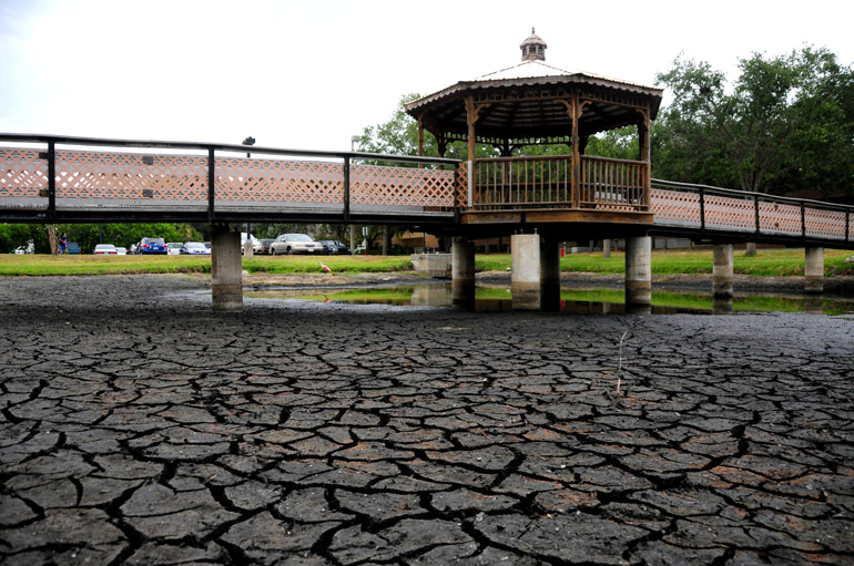
For more than a year, it hasn't really rained much in Brevard County. Or at least, not as much as it should have. This was the scene in the pond at my workplace -- until recently.


In 2010, the National Weather Service in Melbourne recorded 12 inches less rainfall than the area typically receives. The summer of 2010 was virtually deficient of decent thunderstorms, which made it rather boring for weather photographers.

Fortunately, the winter wasn't as horribly dry as some anticipated. The Climate Prediction Center in Maryland forecast below-normal rainfall for Florida during this season, which is usually dry for the state anyway.

But we experienced a few frontal systems that dropped down from the Deep South, bringing us heavy rainfall in early April. Brevard experienced one large wildfire before that: the 17,000-acre "Iron Horse" fire in Mims and Scottsmoor, which I covered tirelessly as a journalist for a whole week.

May, however, was again bone-dry, and water levels dropped and forests burned -- though, luckily, not to any drastic extent. Florida's Space Coast usually starts to experience almost-daily rain showers and thunderstorms in late May. That didn't happen this year.

But in mid-June, a shift in weather trends began. We started seeing the seabreeze off the Atlantic Ocean kick in and blow westward across the Florida peninsula. When it collides with the seabreeze from the Gulf of Mexico, thunderstorms form. This is Central Florida's storm-making machine, which makes it the lightning capital of the United States.

The following photos document this shift as much as I possibly could. There were some days I was working and unable to photograph weather systems or was otherwise occupied with higher callings, like cute girls. And I'm lucky enough to have two of those in my life.
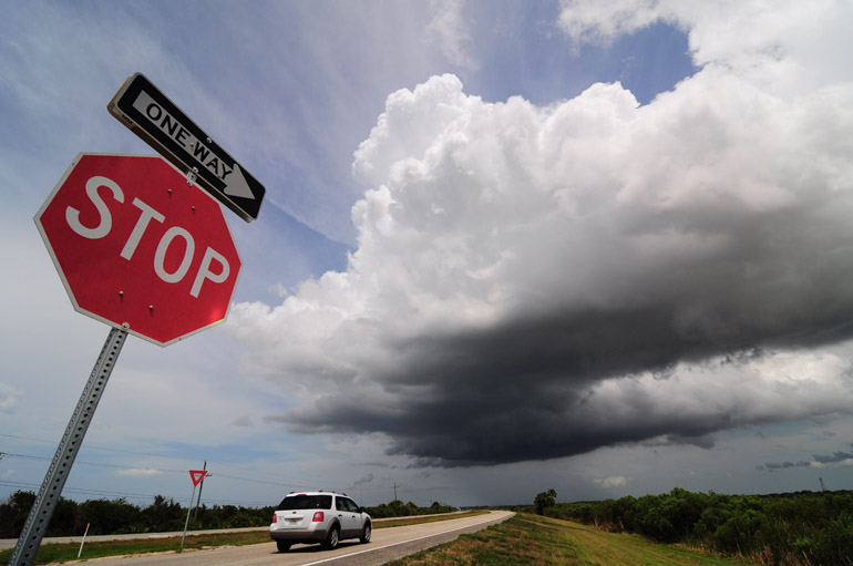

June 12

web_seabreeze
The seabreeze often is visible on radar as a line of light moisture paralleling the Florida peninsula. It doesn't fall to the ground, however. On this day, a clear line of upper-level moisture stretches across the entire sky. Showers formed on this day (when I snapped this picture with my phone while golfing), but they were far to the west of Brevard.
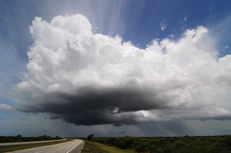
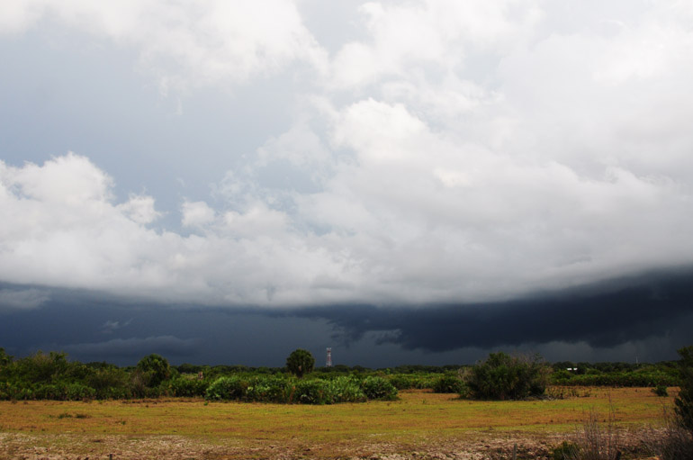
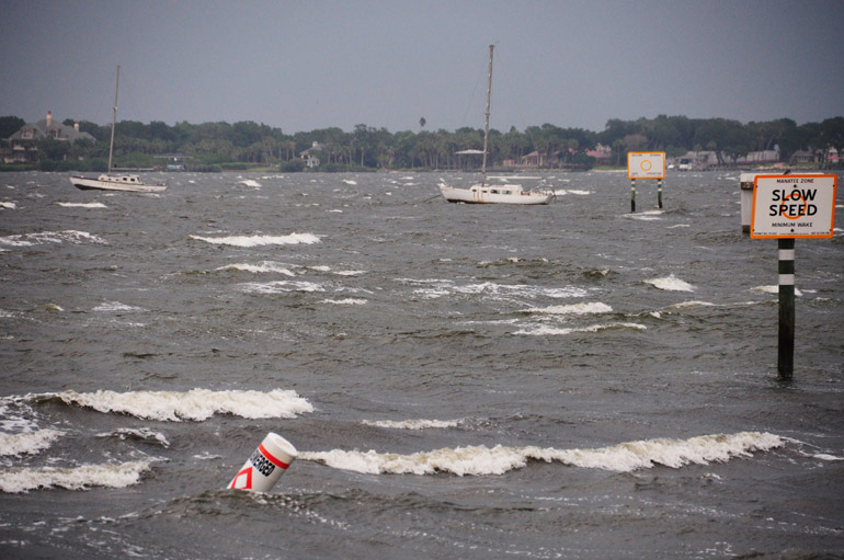
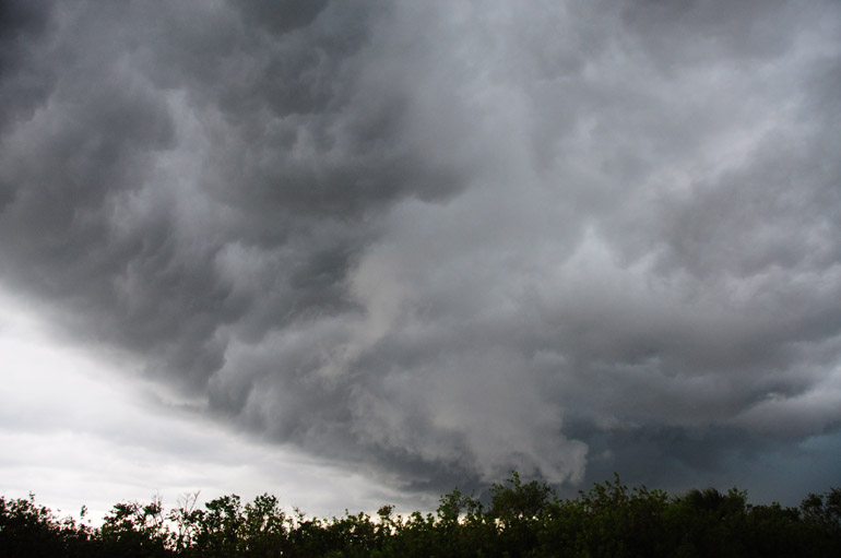
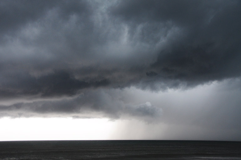

June 14

web_sparks_0028
Things started getting more interesting when a week upper-level area of low pressure dropped into Florida. The trough interacted with daytime heating and convection, and gave rise to widespread thunderstorms. Above, a storm grazed the northern Melbourne area and made for choppy conditions on the Indian River.

web_sparks_0040
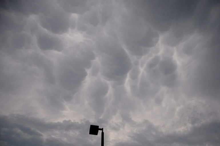
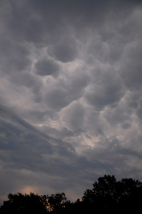
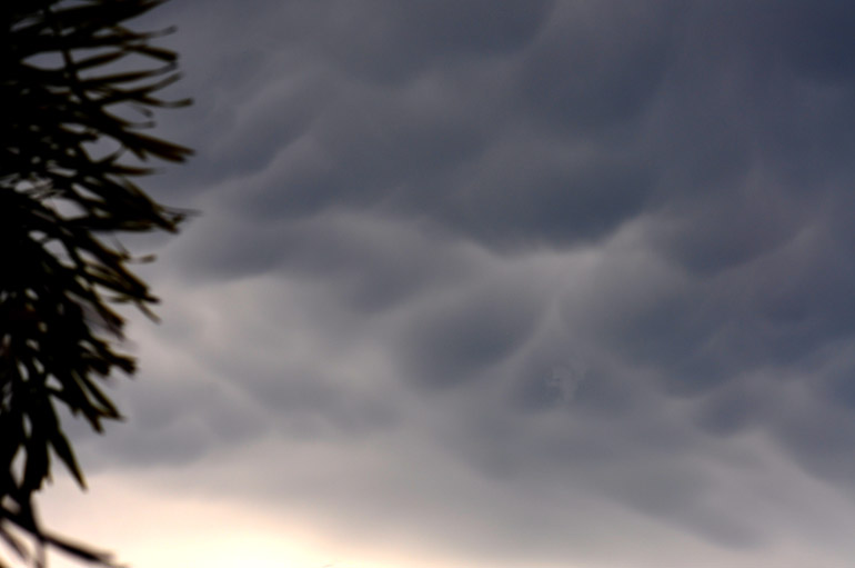
Some mammatus was associated with the first thunderstorm of the day. Just a few rumbles of thunder from this one.

web_sparks_0049
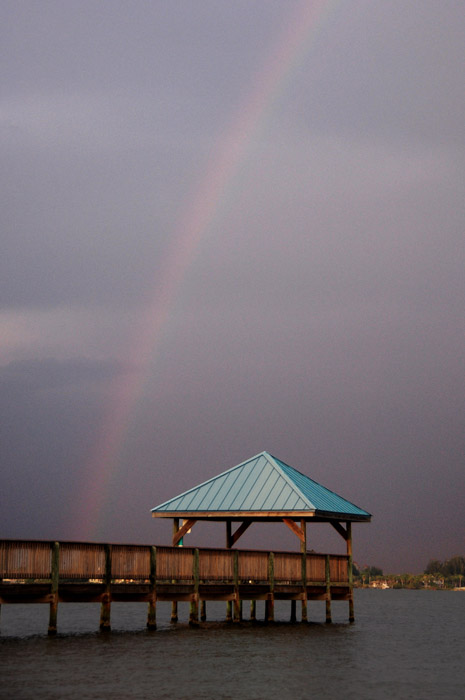
If you want to learn more about mammatus, go here. It tells you how they and other cloud types form.

web_sparks_0110
Late in the day, I waited on the shoreline at Rotary Park in Suntree in hopes to see a rainbow form. I knew the conditions were right. Sure enough, I was rewarded with a faint one.

web_SPARK_0136
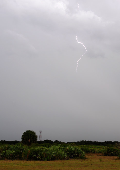
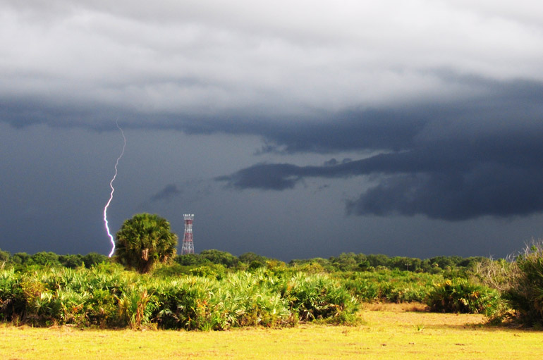
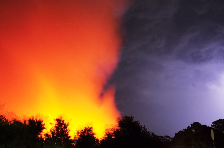
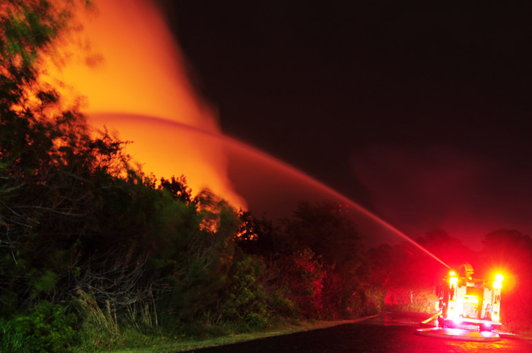
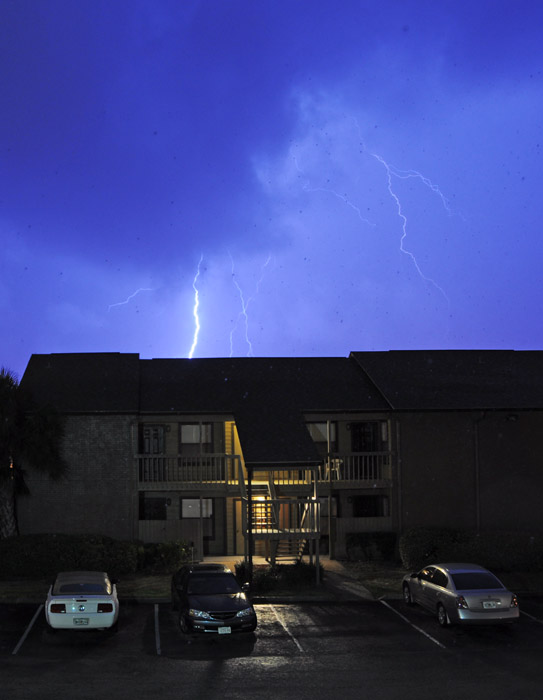
After sunset, around 8 p.m., a second storm system provided a more direct hit to central Brevard County, where I was working at the time. It was brief, but it did bring close lightning and about a minute-long downpour. The lightning, however, was the story: It started this 10-acre brush fire that threatened some buildings in Viera, a well-developed unincorporated area of the county.

web_sparks_0143
There were several instances when the lightning crawled behind the flames, but this is pretty much the best I did in capturing that. The fire engine is blurred because of the long exposure.

web_sparks_0158
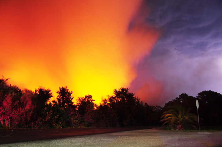
More lightning flashed behind the fire.

web_sparks_0249
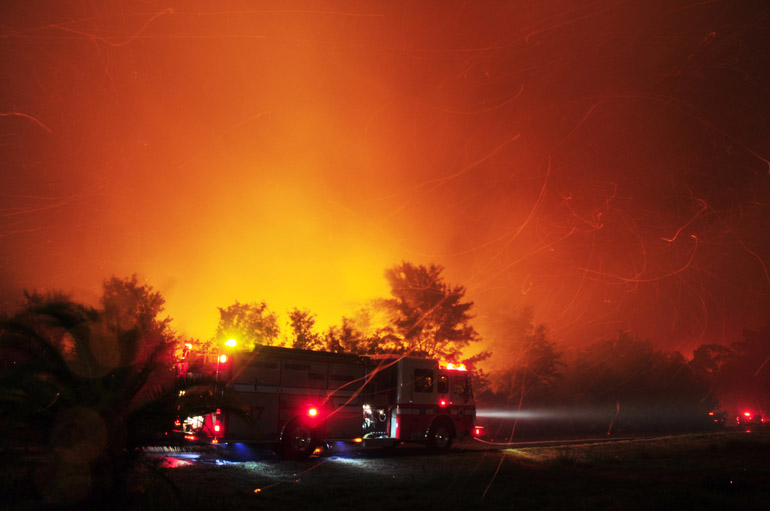
The thunderstorm was still very active as 30 firefighters attempted to contain the blaze. Lightning struck nearby and wind blew embers far from the flames. Those embers swirled throughout this frame.

web_sparks_0260
This is the shot that ran in the newspaper.

web_sparks_0273
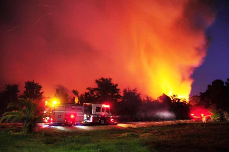
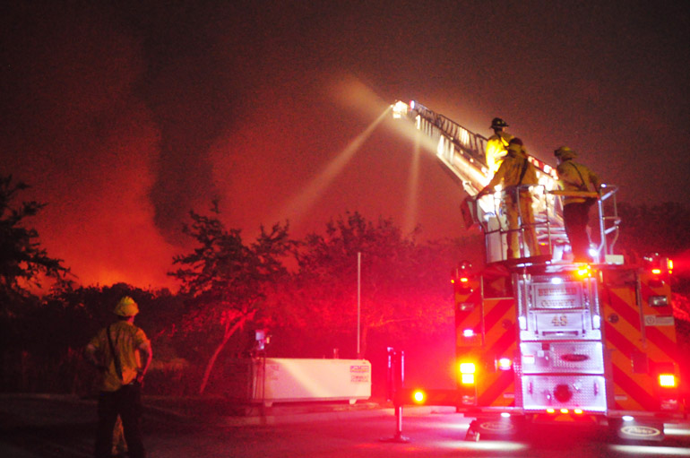
The firefighters waited to attack the flames until they neared this driveway, which led to a child care facility. There are stores and office buildings on the other side of the firetruck.

web_sparks_0322
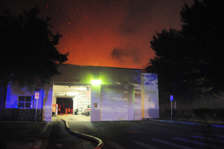
The unique thing about this fire was that it was reported by the fire department. The firefighters from Engine 47 of Brevard County Fire-Rescue were responding to a call when they saw the smoke in their rearview mirrors. Their station is shown above.

web_sparks_0333
Firefighters used their ladder truck to get a bird's-eye view of the wildfire. They contained it, and despite some drama, no damage was done.
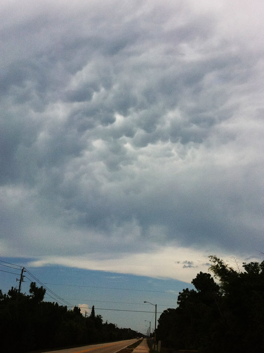

June 15


webb_crepuscular
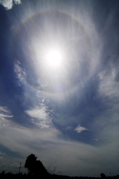
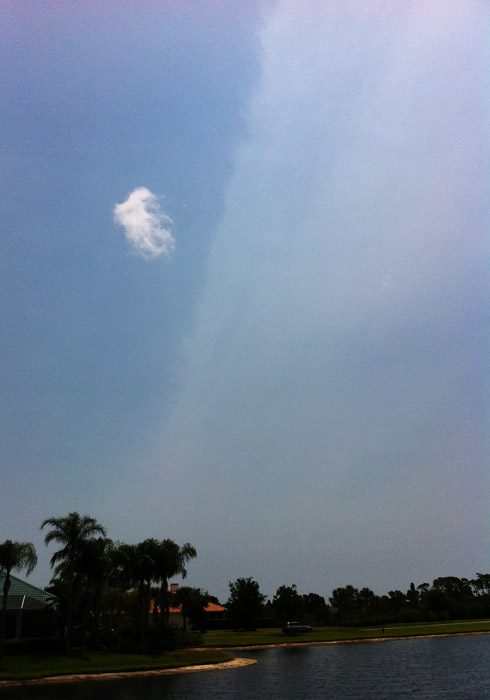
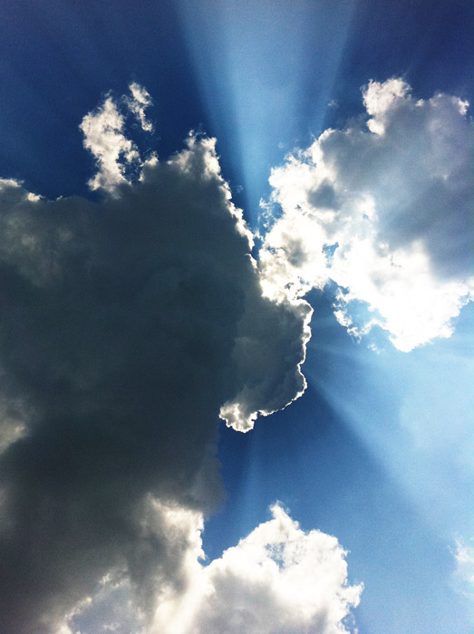
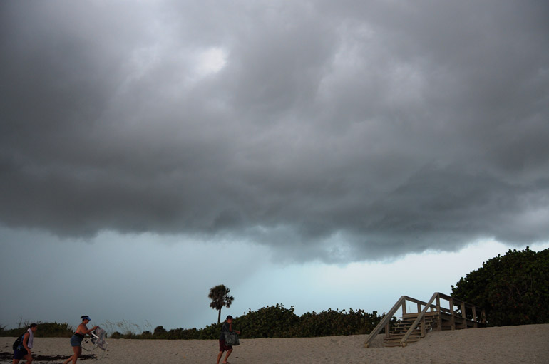
No storms, just clouds. But after a long winter of mostly clear skies and lots of sunshine, this was a welcome sight. Taken with a phone.
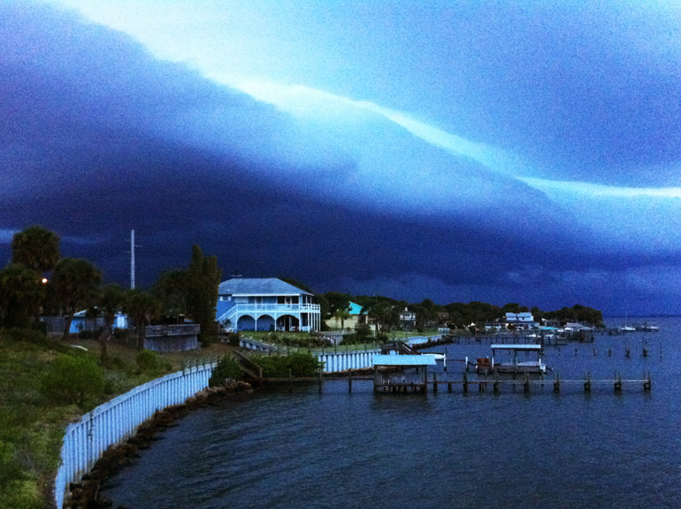
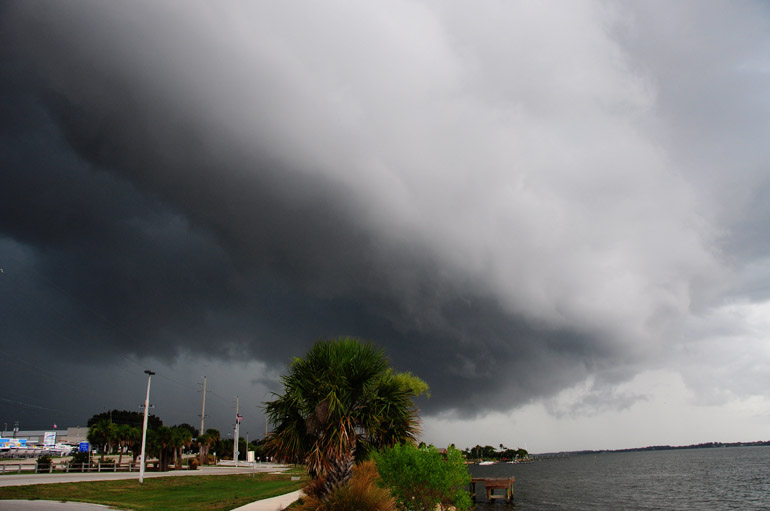
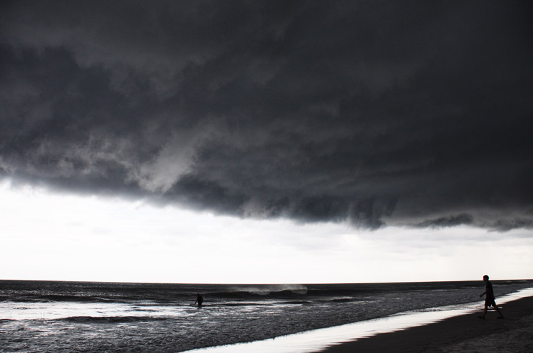
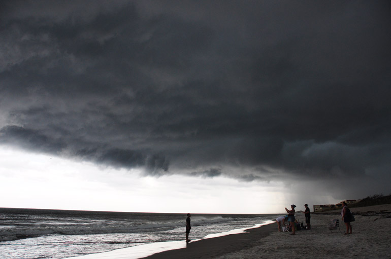
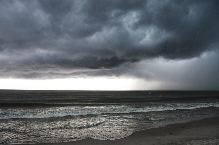

June 18

web_bonefish_shelfcloud
I'm guessing this was the most intense storm Melbourne has received this year. I was dining at a nearby seafood restaurant on the Indian River when it rolled in. I snapped this shot of the gust front with my iPhone.

web_stormbonefish_lightning_0374
I went home and did not venture into the storm, but I did take one shot from my front "porch."
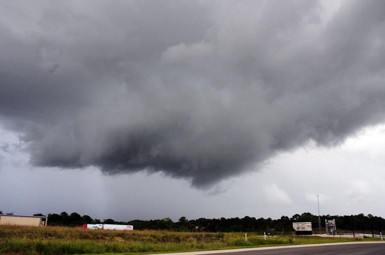
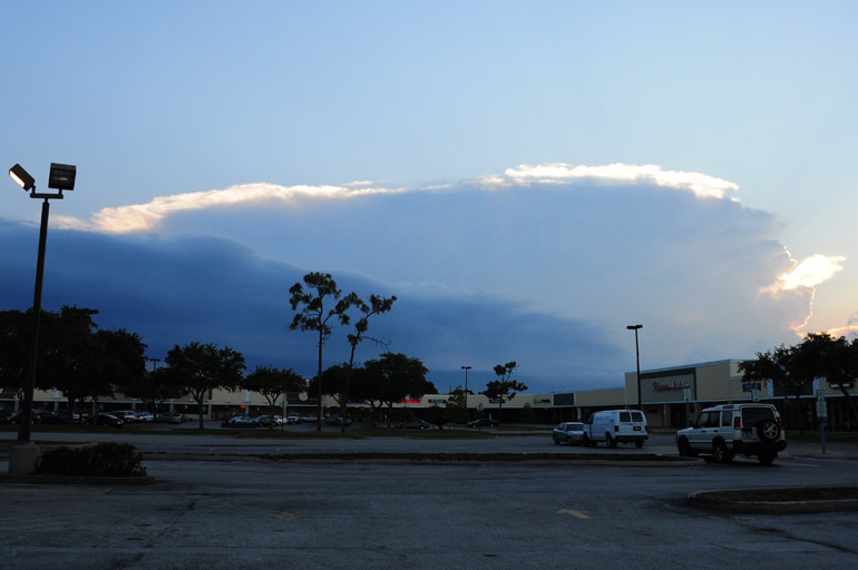
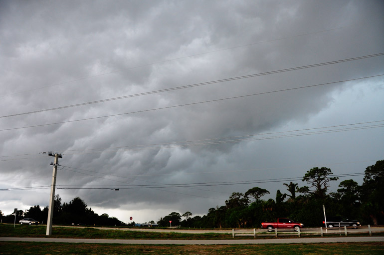

June 19

web_stormanvil_wide_0002
We did not receive significant weather on this day, as most storms were confined to the state's interior. The Atlantic seabreeze was the strongest of the day, so it pushed far inland and collided with the Gulf seabreeze far to the west. This storm created quite an anvil cloud.

web_stormanvil_close_0006
I think this storm was over in Osceola County.

web_stormanvil_tail_0012
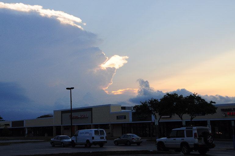
The sun set behind the storm. Some rays shot from behind this little tail that extended from the side of the anvil.


June 24

web_rainy_crimescene_0159
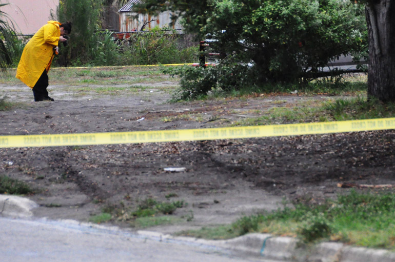
In more recent times, a trend of daily showers and thunderstorms has developed. On Friday, it rained in Melbourne from about 6 p.m. until nearly midnight. I was busy covering a homicide in which a man was shot and his buddies tried to take him to the hospital. Crime-scene investigators struggled to document the scene during rainfall. Several police officers muttered to me things like: "It hasn't rained in weeks, but now that we have a murder outside, it rains."

Sunday, June 26, 2011

Wet season teaser: raindrops and mammatus

web_rain_0093
I snapped a few shots of the rain with my macro lens. Above, cumulonimbus clouds are reflected through raindrops on a windshield.


Trying to play catchup on my blog.

We had a few May days here in Central Florida that were a precursor to the wet season.

These photos were taken during a weak storm system that grazed the area on May 27, bringing only a few drops and a few lightning strikes.

The rainfall wasn't even measurable. Definitely not enough to jumpstart the rainy season here.


web_rain_0158
A stop sign seen through my windshield.

web_mammatus_0170
Mammatus clouds formed over the northern Melbourne area. They typically indicate moisture air sinking into dry air. It had been very dry here: an "extreme" drought.

web_raindrops_big_0081
Raindrops on my sunroof looked more like specimens on a microscope slide.

web_mammatus_iPhone
Some mammatus appeared earlier in the day, too. I snapped this shot with my iPhone while taking a run.

web_sunsetsayapartment_0001
Finally, we started getting clouds in the atmosphere. Must have moisture available for thunderstorms to form.

Severe storm forms overhead in first 'chase' of the season

teaser_stormpatrick_pano
Panorama of the storm that developed as I "chased" it to the ocean. Click here for a full version.

web_stormpatrick_leadingedge_0015
My first stop was a park near a little town called Palm Shores (it derives its namesake from the Indian River). This is where the clouds started to develop some structure. Radar showed some rain activity off to the west by this point.


First of all, I resent the term "chase" when it comes to weather photography -- simply because it has the connotation that you're behind something and you're trying to catch up.

I just think it's good to be ahead of the weather. I like to let it come to me.

Unfortunately, that was not the case on the first day this season that I dedicated to weather photography. So yeah, I guess you could call this a "chase."

I've spent the past two days tracking down clouds that are popping up regularly in Brevard County now that our rainy season has finally begun (that post is coming later).

Without social events scheduled, I pretty much dedicated myself to this activity.

And it started early Saturday afternoon.

Radar showed a few showers to the south and to the north, but I looked to the sky and decided to trust my own instinct on a few dark clouds to the west. (Truthfully, I have no instinct; I don't know what I'm doing. I just like clouds.) So I got in front of them, and it turned out that a severe thunderstorm formed right over my head.

Unfortunately, I wasn't far enough south to get an overall view. Photographers in Indian Harbour Beach -- about 6 miles from Patrick Air Force Base, where I ended up -- got shots like this of a beautiful shelf cloud (the leading edge of a well-developed thunderstorm's outflow, also known as a gust front).

Better luck next time. And hopefully there will be plenty of next times this summer.


web_stormpatrick_forming_0025
The turbulent, ragged appearance of the clouds -- also known as the "whale's mouth" effect -- provides a clear sign that there's plenty of air movement.

web_stormpatrick_scuds_0031
There were a few scuds, or clouds that droop from a larger one. They're often mistaken for funnels, but they have no rotation.

web_stormpatrick_underside_0053
This is where my chase ended, for obvious reasons -- the utmost of them being that I don't have a boat to chase on the Atlantic Ocean.

web_stormpatrick_pictures_0054
I always run into tourists who are fascinated by the clouds (like I am, even though I'm not a tourist). But at this point, people left on the beach needed to gather their things and get moving. It's not the best place to be when lightning starts getting frequent.

web_stormpatrick_pickup_0063
I turned around and tried to snap some shots of lightning, but it was too fast and shifty. The tourists got smart and left. I stayed standing next to my tall tripod.

web_stormpatrick_sea_0113
The rain fell over the ocean to the south. I was still dry on the beach at Patrick Air Force Base.

web_stormpatrick_raining_0114
Now the rain comes, and I go.