Friday, September 23, 2011

Finally, a decent lightning storm while I'm not at work

web_lightninglonecabbage_composite_0177
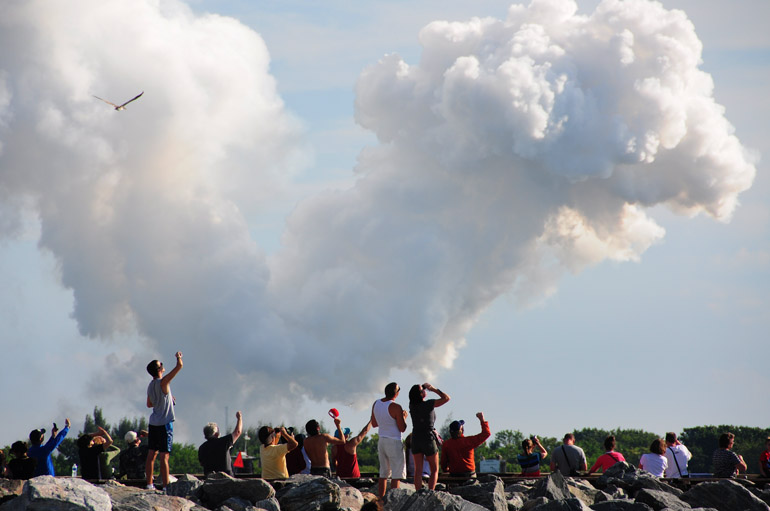
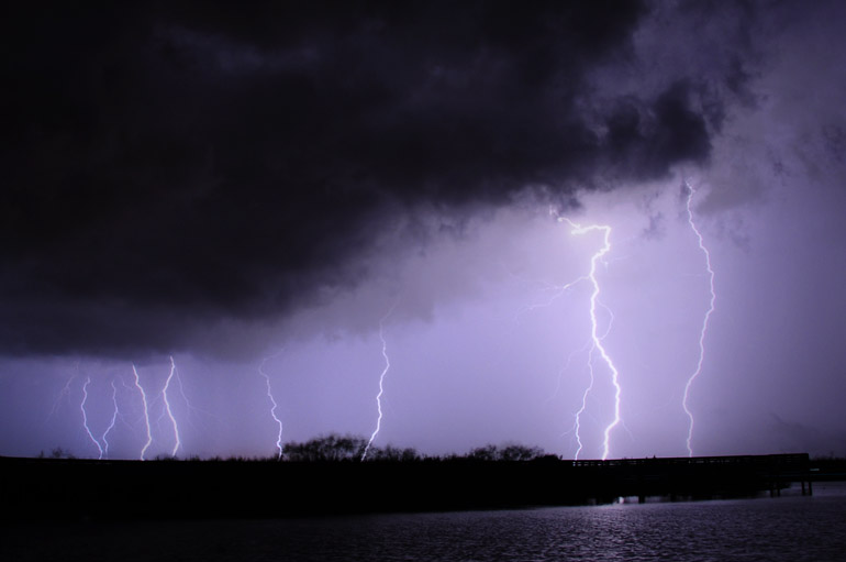
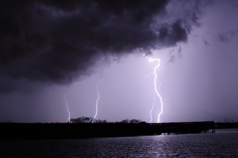
I walked out of work Friday evening and checked the radar on my iPhone. It showed a big, almost stationary blob of red just to the west of Cocoa. Seemed like a good photo op for stormy clouds and lightning. The above is a composite of a few lightning photos I took over a 15-minute period at the Lone Cabbage Fish Camp on the St. Johns River.

web_shelflonecabbage_sunset_0016
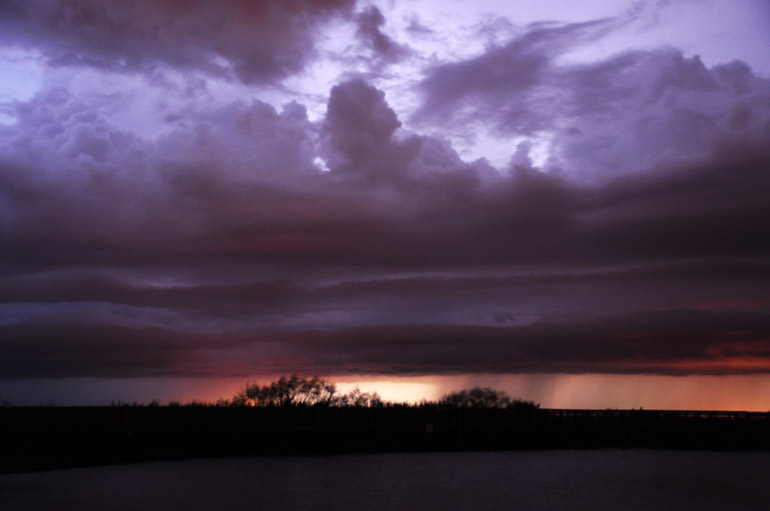
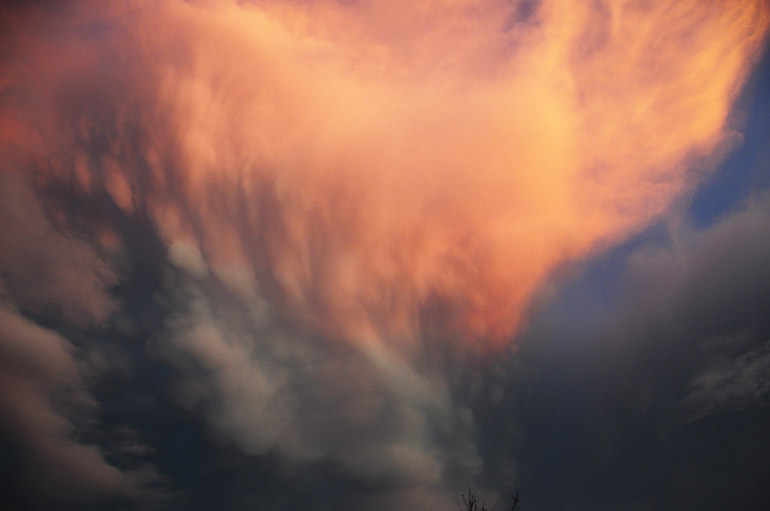
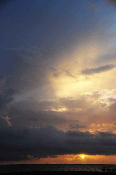
I started the evening at a park on the north side of State Road 520, which runs westward into a remote, swampy area. It had a good view of this gust front, with a somewhat red post-sunset sky in the background.

web_lonecabbage_shelf1_0038
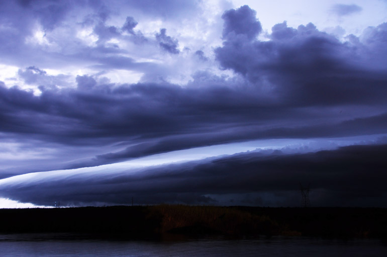
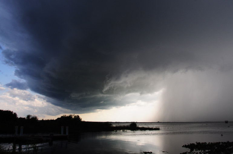
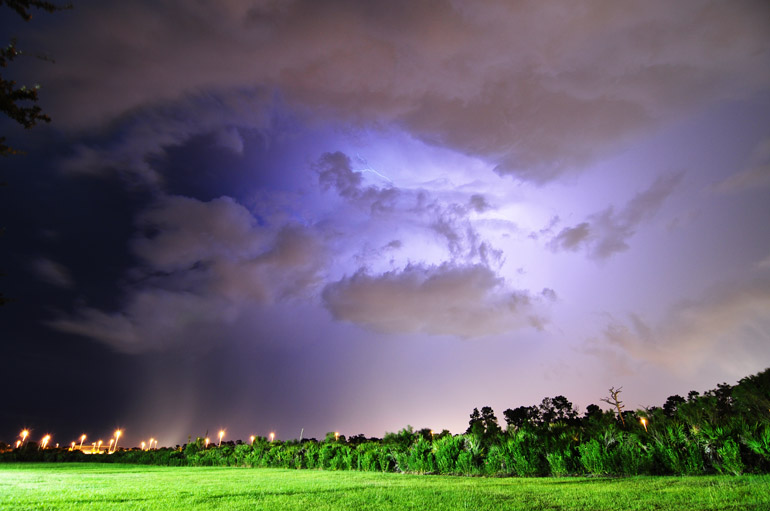
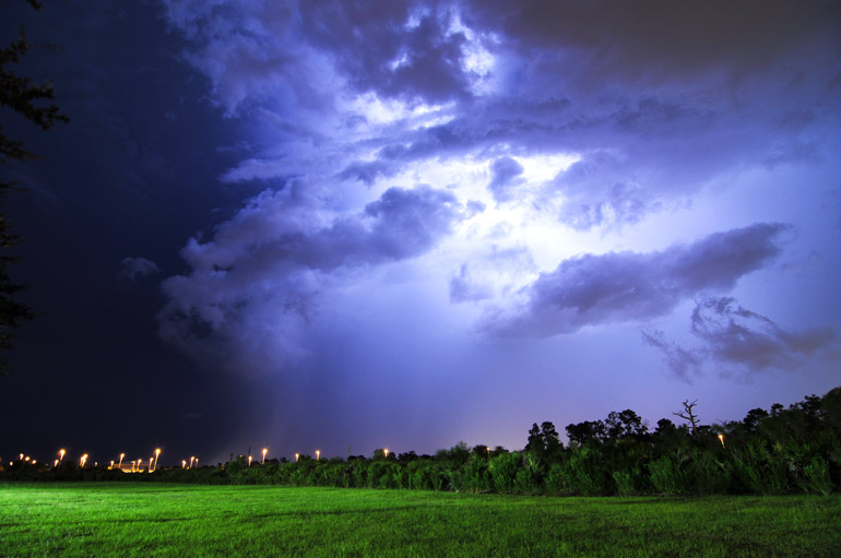
I switched to a park on the south side of State Road 520 so I could get a better view of the storm's structure. The lightning was flashing frequently, highlighting the striations in this shelf cloud. Visible bolts, however, were few and far between until the storm got closer.

web_lonecabbage_glow_0095
This shot shows a lightning strike, but the area of the bolt is overexposed, so you can't make it out.

web_lonecabbage_italianflag_0046
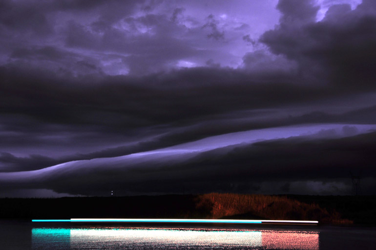
The green, white and red lights on an airboat that went by oddly made an Italian flag over the river's surface. Weird, huh?

web_lightninglonecabbage_threebolts_0177
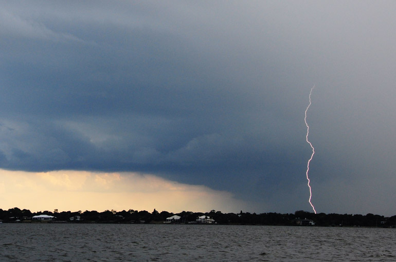
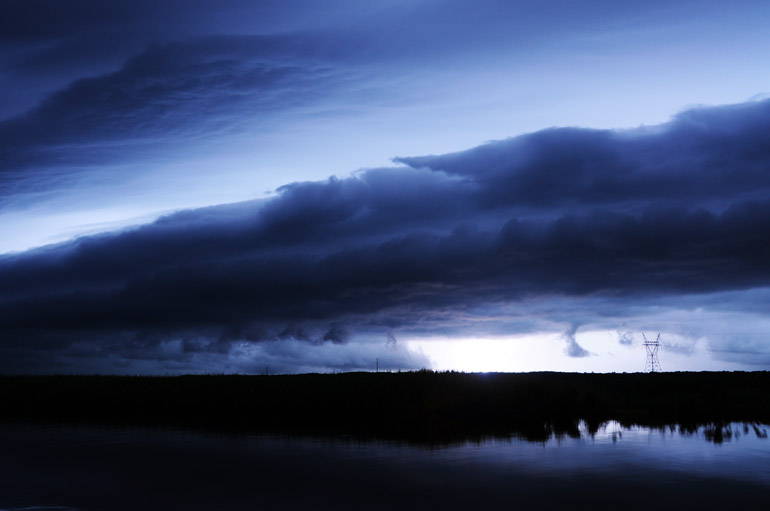
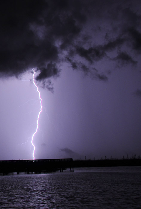
I went back over to the north side of the roadway, where there seemed to be a better view of the lightning bolts.

web_lonecabbage_bolt_0174
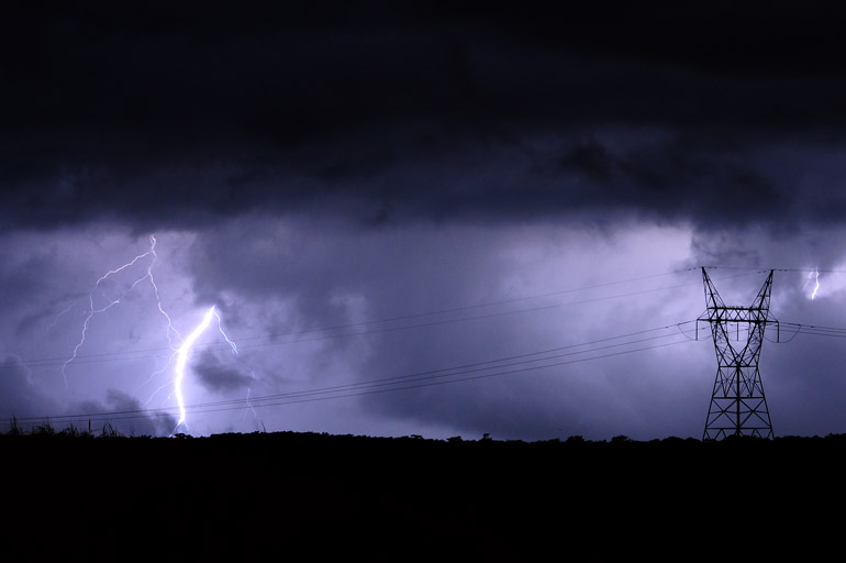
The storm was painfully slow in moving eastward toward my location. I'm betting its clip was less than 5 mph.

web_lonecabbage_powertower_0129
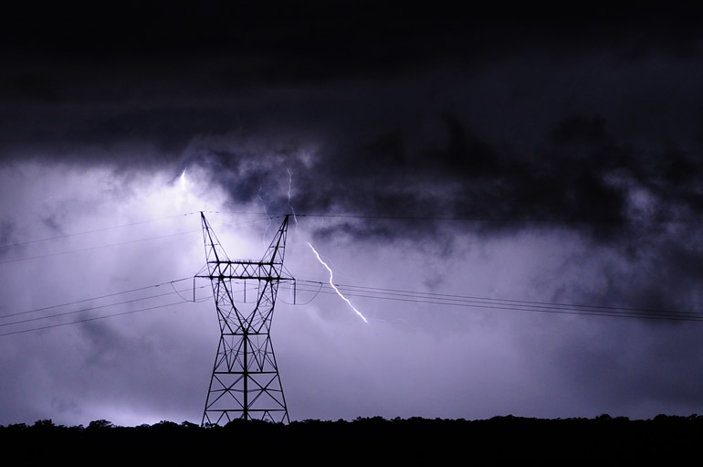
I always try to focus on power towers, since they're tall, and lightning loves tall things. This was never struck, however.

web_lonecabbage_powerline_0138
It eventually started sprinkling, and since I was exhausted from a long workweek, I called it an evening.

Sunday, September 11, 2011

Delicate storms, beautiful sights

web_raindbow_chase_0169
Saturday provided some pretty albeit tame weather. I started and ended by chasing some lightning in two separate storms, the results of which are below. For the late-afternoon storm, I waited on the beach for the rain to go out to sea. I was anticipating perfect conditions for a full rainbow: The storm was small and clearly defined, so once the system went over the ocean, the setting sun would break through in the west and make for a nice bow over water in the east. And that's precisely what happened. I shot this double rainbow at Patrick Air Force Base (my lens wasn't wide enough to pick up the second bow).

web_storms_rainbowchase_0004
I started Saturday afternoon at Lake Washington, which is just west of Melbourne proper. The west and east coast seabreezes collided here and a storm quickly formed. When I snapped this shot, lightning was striking every 10 seconds, signaled by loud thunder each time -- an amazing site and sound that I did not catch on film.

web_lightningbolt_rainbowchase_0044
I drove to the Indian River and stopped on the Eau Gallie Causeway, just to get out of the rain. I tried to shoot the lightning from afar. There was a decent amount of bolts on the storm's leading edge. Many traveled into the clear blue sky in front of the storm. This was the only bolt I caught.

web_mammatus_rainbowchase_0205
After the rainbow, I picked up some groceries. When I emerged from the store after sunset, some mammatus clouds were drooping toward the ground.

web_raincore_bolt_0077
Around 10 p.m., another storm formed well south of my apartment. I didn't chase it, and by the time the northbound storm reached me, it contained only intracloud lightning. Few of the bolts were actually visible.

web_raincore_glow_0065
The lightning nicely illuminated the clouds and the heavy rain core beneath them. There's nothing spectacular with any of these shots, but they do go to show that every storm has a unique look.

Saturday, September 10, 2011

NASA's GRAIL Delta II rocket launch, on the rocks

web_rocket_main_0060
United Launch Alliance sent NASA's GRAIL spacecraft toward the moon, where it will map the natural satellite's gravitational field. These spectators watching the Delta II Heavy rocket lift off apparently didn't read the sign.

web_grailjetty_wide_0062
The Delta II has long been my favorite rocket to watch lift off from Cape Canaveral Air Force Station. Its pad, 17B, is the closest the general public can get to a launch: 2.9 miles from Jetty Park in Port Canaveral.

web_grailjetty_vertical_0065
But Saturday morning's launch, at 9:08 a.m., was the last for a Delta II in Florida. Without the Delta II and the shuttle, I'm losing interest in the space program.

web_grailjetty_crooked_0073
I briefly stepped into the water for a few shots.

web_grailjetty_sun_0083
The rocket started approaching the sun.

web_grailjetty_shadow_0097
The rocket shed its solid-fuel boosters and cast a shadow on the mackerel sky.

web_grailjetty_contrail_0088
People on the rocks shielded their eyes from the sun as they continued watching the flight.


Here's a video taken on my iPhone. I set it on my tripod and let it run while I took photos.

Monday, September 5, 2011

Hurricane Irene's brush with the Space Coast

web_stormsurge_hurricaneirene_0115
Irene's waves covered a wide swath of Cocoa Beach, causing some erosion but no serious damage.


Five days before its projected landfall, Hurricane Irene appeared to be heading directly toward Brevard County. But I remember someone in the Florida Today newsroom saying that if we're in the bull's-eye five days prior to a storm's estimated time of arrival, chances are good that we won't get hit at all.

That proved accurate.

The storm turned to the northeast, and its center passed about 200 miles east of the Space Coast. At the time, though, Irene was about 400 miles wide, so we did feel some limited effects of the Category 3 hurricane.

We had two bands of heavy rainfall that Thursday afternoon, but accumulations were no more significant than in typical summertime thunderstorms.

I drove to the beach, however, where the storm surge was more than I was expecting.

The waves washed over the grassy dunes and lapped at the steps of the boardwalk in southern Cocoa Beach. Ocean water covered an approximately 100-yard-wide beach. For a storm that was 200 miles out to sea, I thought that was pretty impressive, and it left me curious as to what the conditions would be like if such a storm actually made landfall here. I have not yet experienced that.

Maybe someday.


web_seaoats_hurricaneirene_0089
I had actually stashed my sandals behind the sea oats, pictured here, thinking they would be safe from the surf. The waves ended up reaching my footwear, however. Fortunately, they were not swept out to sea, and I recovered them.

web_waves_hurricaneirene_0081
A very angry Atlantic Ocean just after sunset.

web_sunset_hurricaneirene_0068
Earlier, this was the sunset over the Banana River, just west of where I was snapping the surf photos on the barrier island of Cocoa Beach.